Image

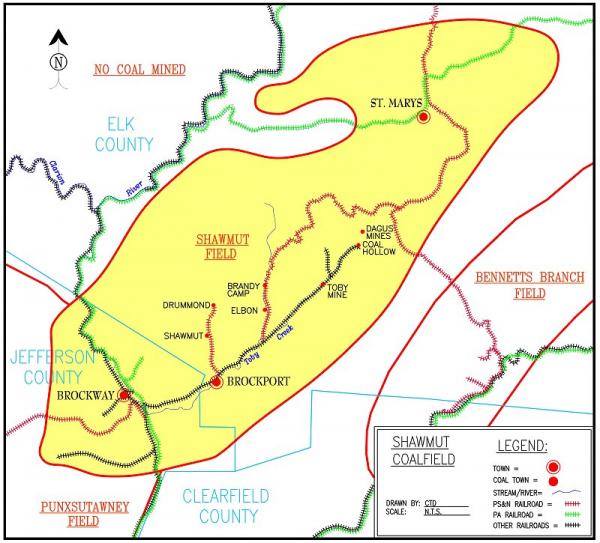
Shawmut Coalfield Map
Credit: Courtesy of Chris DellaMea, www.coalcampusa.com/
This coalfield is named Shawmut Coalfield on the USGS map of Pennsylvania coalfields. It is unclear if it was named after the Shawmut Railroad, the Shawmut Mining Company, or the coal patch named Shawmut. Shawmut was a coalfield that generally focused on mining the Lower Kittanning seam of coal. Mining the Lower Kittanning in this area meant mining a low seam of coal that was only 36-40 inches in height.


