![header=[Marker Text] body=[Stood on this site. It was completed in 1792. Built to protect Pittsburgh against Indian attacks and to serve as a chief supply base for Gen. Wayne's army, 1792-94. Reactivated during the War of 1812. Site sold in 1813] sign](http://explorepahistory.com/kora/files/1/10/1-A-291-139-ExplorePAHistory-a0h9g6-a_450.jpg)
Mouse over for marker text
Name:
Fort LaFayette [New Nation]
Region:
Pittsburgh Region
County:
Allegheny
Marker Location:
9th St. just N of Penn Ave., Pittsburgh
Dedication Date:
December 1958
Behind the Marker
The American Revolution officially ended in 1783 with a peace treaty signed in Paris, but that piece of paper did little to resolve the hostilities between the Indians and whites who lived in western Pennsylvania. During the 1780s, animosity remained high between these two groups. In 1782, Pennsylvania militia massacred peaceful Conestoga Indians at Gnadenhutten in what is now Ohio; less peaceful Indians then retaliated by capturing and torturing to death  Col. William Crawford. That same year they burned Hannah's Town, intended as the capital of Westmoreland County, to the ground.
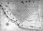
In 1784, the federal government attempted to mount an expedition against the Indians, using enlistees and what was left of the Continental Army. But the effort failed when the unpaid and unruly soldiers rebelled against their officers and terrorized the local population in and around Pittsburgh. Within two years, the army had improved somewhat, but protecting settlers along the Ohio River near Pittsburgh was as much as it could do. Meanwhile, settlers pushing farther west were provoking Indians into a war that the government did not want to fight.
After Sullivan's campaign of 1779, the United States had claimed ownership of the Ohio Valley, even though Native Americans living in the region had never been defeated by either Pennsylvania militiamen or Continental soldiers. There, Delaware, Shawnee, and Iroquois who had formerly inhabited the northern Susquehanna, Allegheny, and Ohio valleys, continued to ally themselves with British troops in Ontario and Detroit. At the treaty of Fort McIntosh, signed in 1785, some Indians signed away much of the Ohio Valley to the United States, without the consent of those who lived there.
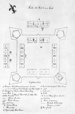
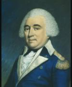
In two successive campaigns against the Ohio Indians in 1790 and 1791, the United States Army suffered humiliating defeats, the second under General Arthur St. Clair. The United States then failed to make treaties with the successful Indians. This devastating turn of events raised the specter of renewed Indian warfare in western Pennsylvania, which in turn prompted the construction of Fort Lafayette in Pittsburgh as a supply center for Fort McIntosh, located below Pittsburgh on the Ohio River, and Fort Steubenville in Ohio, which held the front line against the hostile Indians. When General Anthony Wayne arrived in 1794 to lead a new expedition into the Ohio Valley, he assembled his undisciplined troops at Fort McIntosh, so that they would not get into trouble with the taverns and townsfolk of Pittsburgh.
In August, 1794, Wayne's army defeated the Ohio Indians near modern Toledo at the Battle of Fallen Timbers. The following year, the Treaty of Greenville forced them to withdraw into the Indiana Territory. After forty years of violence and bloodshed, the Indian defense of the Ohio-Allegheny watershed had finally been broken.
A decade later, Fort Lafayette was used as a staging ground for the Lewis and Clark Expedition. When Meriwether Lewis left Washington D.C. on July 5, 1803 to begin his long trek across the North American continent, his well-supplied expedition still had no men or co-leader. Nor did it have the keelboat needed to carry the expedition and its supplies down the Ohio River to St. Louis. The Lewis and Clark expedition began not in Washington D.C. or Philadelphia, but in Pittsburgh; the Gateway to the West. Fort Fayette later served the nation as Commodore Perry's supply base during the War of 1812, before the Army abandoned it in 1814.
To learn more about Indian removal from western Pennsylvanian and the Fort's role in the Lewis and Clark expedition click here.
In 1784, the federal government attempted to mount an expedition against the Indians, using enlistees and what was left of the Continental Army. But the effort failed when the unpaid and unruly soldiers rebelled against their officers and terrorized the local population in and around Pittsburgh. Within two years, the army had improved somewhat, but protecting settlers along the Ohio River near Pittsburgh was as much as it could do. Meanwhile, settlers pushing farther west were provoking Indians into a war that the government did not want to fight.
After Sullivan's campaign of 1779, the United States had claimed ownership of the Ohio Valley, even though Native Americans living in the region had never been defeated by either Pennsylvania militiamen or Continental soldiers. There, Delaware, Shawnee, and Iroquois who had formerly inhabited the northern Susquehanna, Allegheny, and Ohio valleys, continued to ally themselves with British troops in Ontario and Detroit. At the treaty of Fort McIntosh, signed in 1785, some Indians signed away much of the Ohio Valley to the United States, without the consent of those who lived there.
In two successive campaigns against the Ohio Indians in 1790 and 1791, the United States Army suffered humiliating defeats, the second under General
In August, 1794, Wayne's army defeated the Ohio Indians near modern Toledo at the Battle of Fallen Timbers. The following year, the
A decade later, Fort Lafayette was used as a staging ground for the Lewis and Clark Expedition. When Meriwether Lewis left Washington D.C. on July 5, 1803 to begin his long trek across the North American continent, his well-supplied expedition still had no men or co-leader. Nor did it have the keelboat needed to carry the expedition and its supplies down the Ohio River to St. Louis. The Lewis and Clark expedition began not in Washington D.C. or Philadelphia, but in Pittsburgh; the Gateway to the West. Fort Fayette later served the nation as Commodore Perry's supply base during the War of 1812, before the Army abandoned it in 1814.
To learn more about Indian removal from western Pennsylvanian and the Fort's role in the Lewis and Clark expedition


