Image

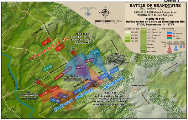
Birmingham Hill Fields of Fire
Credit: Chester County Planning Commission
This map from the Chester County Planning Commission shows the placement of Continental and British forces during the Battle of Brandywine and the fighting near Birmingham Hill.


