


Credit: The MODIS Rapid Response Team at NASA GSFC
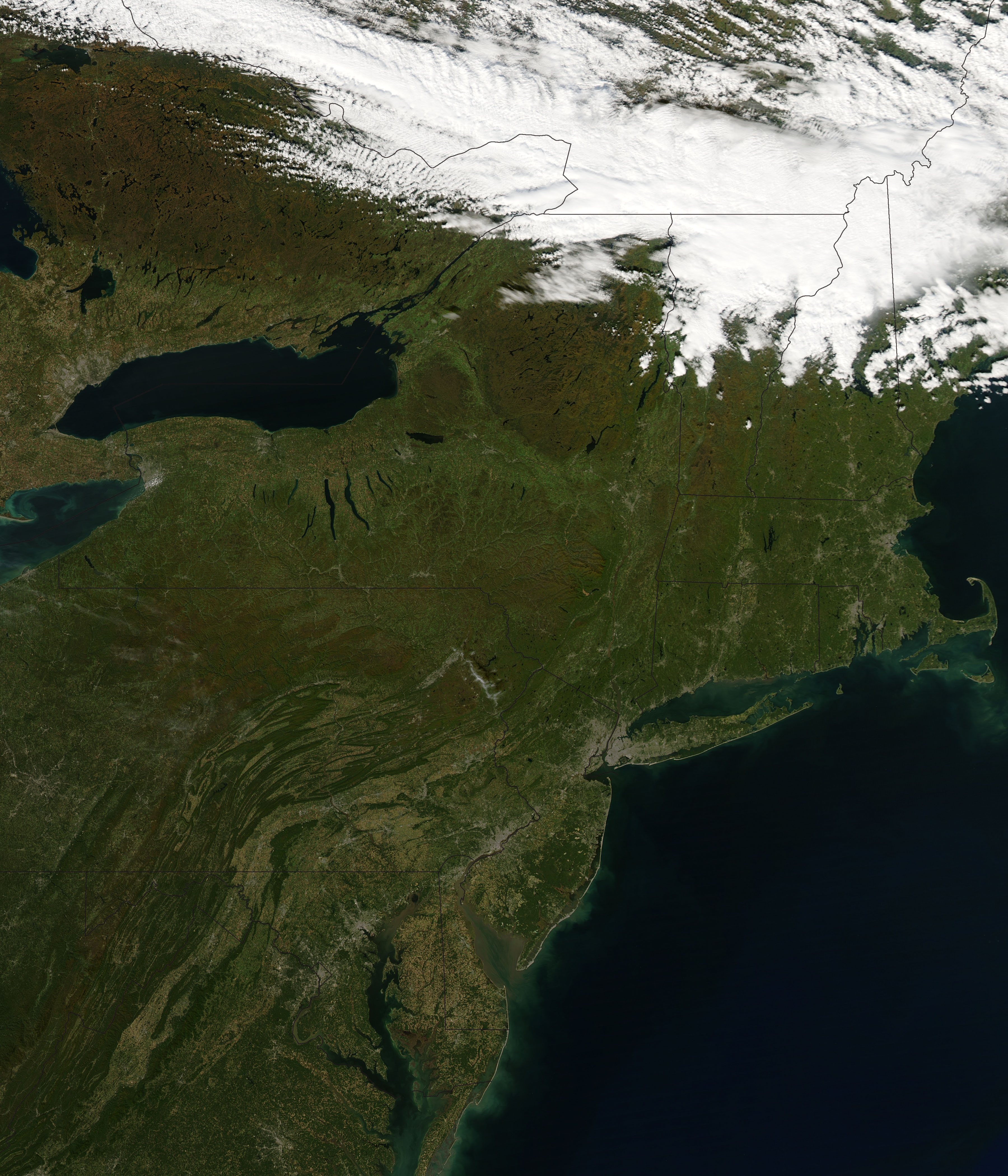
In this satellite photograph of the northeastern United States one can see how the Allegheny Mountains run diagonally across Pennsylvania, forming a barrier between the eastern coastal plains and the Ohio Valley to the west.
