Image

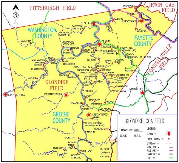
Klondike Coalfield Map
Credit: Courtesy of Chris DellaMea, www.coalcampusa.com/
Klondike coalfield opened around 1900 to mine a rich, thick section of the Pittsburgh seam. Klondike field coal was shipped by barge on the Monongahela River, which gave this field an advantage over rail-dependent fields such as Connellsville.


