Chapter 3: The Settlement of Western Pennsylvania
In the United States, we talk about "settlement," while in Latin America, they speak of the "conquest." Conquest implies fighting and governing the people encountered, as the Spanish did with the Indians. Settlement, on the other hand, implies clearing the area of those already living there so those who defeat them can take their place.
From the time William Penn founded Pennsylvania in 1682, there were two theories about how the land was to be occupied. When he began Philadelphia, Penn was obliged to chase out the disreputable people who had inhabited caves along the Delaware River. Similarly, the Quaker government, until the French and Indian War, and then the British government until the American Revolution, insisted land be legally obtained by deed from the government, although some of these purchases, especially the infamous
  Walking Purchase of 1737 and the Iroquois transfer of Delaware lands to Pennsylvania at the Albany Congress of 1754, were hardly legitimate sales.
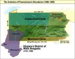
In the 1700s, other colonies claimed much of the land that is now Pennsylvania. The boundary with Maryland wasn't settled until agreement upon the Mason-Dixon Line in 1763. Virginia and Pennsylvania settled their differences by 1781, but Connecticut and Pennsylvania continued to dispute the north until Congress awarded the land to Pennsylvania in 1786. In the worse case scenario, Pennsylvania would have been about half its present size, and without much of its forests and coal deposits.
At the conclusion of the American Revolution, the victorious patriot leadership realized the wisdom of the colonial and British governments had demonstrated in trying to control settlement. Frontier battles - including the French and Indian War and Pontiac's Rebellion- usually began when small groups of unauthorized settlers and Indians clashed over disputed territory. Furthermore, once the American Revolution was over, George Washington and other leaders feared that unless settlement was carefully controlled and led by men with strong ties to eastern leaders and markets, frontiersmen were likely to be courted by the Spanish in Louisiana and the British in Canada and Florida. Numerous plans for a "Westsylvania" or "Transylvania" to secede from the Union circulated around the west in the 1780s and '90s, although historians know little about them aside from the rumors that reached the east.
Eastern leaders were also concerned about the character of western society. They wanted to build roads linking the two regions, ensuring orderly commercial development so western society would resemble that of more settled regions. Without such ties, the west, they feared, would be poor, disorderly, and "democratic," in the worse possible sense of the word. Washington and others also feared that speculators who lacked attachment to the government would take over large tracts and become inordinately powerful without a regulated advance to the west. Western lands were also the most valuable resource the federal government could sell to pay a national debt that had finally stabilized: United States certificates were selling at high prices in Europe.
Securing the western territories negotiated by the Americans at the peace of Paris in 1783, however, was not easy. The year before, Indians destroyed Hannah's Town, the intended capital of newly-formed Westmoreland County, and Pennsylvania frontier militia massacred peaceful Moravian Christian Indians at Gnadenhutten in what is now eastern Ohio.
The British may have lost the war in the east, but their Indian allies had held their own in the west, and were still a powerful military force. In 1784 Pennsylvania forced the New York Iroquois to give up their claims to what amounted to about one-third of the state's current territory. In the years that followed, Pennsylvania tribes not party to this and other treaties, attempted to co-exist, fled west, or continued to launch periodic attacks against white settlers along the western border of the state.
Indian armed resistance strengthened when white settlers made their way onto their lands in western Pennsylvania and the Ohio Valley. In 1790, Little Turtle and 1,500 Miami, Wabash, and Shawnee warriors overwhelmed Pennsylvania troops that General Josiah Harmer had led into the Ohio Valley to subdue them. The following year, General Arthur St. Clair led his 2,100 troops into one of the worst defeats into the history of the American Indian wars. Alarmed at the mounting Indian threat in the west, Washington in 1794 sent General Anthony Wayne to Pittsburgh where he mustered an army at
  Fort Lafayette. Wayne then led his army to a decisive victory at the Battle of Fallen Timbers in northwestern Ohio.
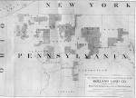
The succession of forced treaties and military actions opened the lands north and west of the Alleghenies to investors, speculators, and settlers. Settlers poured into the woods of western Pennsylvania and carved out farms and settlements, as investors and real estate speculators back east bought up millions of acres. Southwestern Pennsylvania, what is today Washington, Greene, and Fayette Counties, was the first region to experience settlement. All of George Washington's western lands were located here, as he was reasonably confident that it would become part of Virginia. In 1771 Washington, had bought 2,813 acres in present-day Washington County. In 1784 he was forced to bring suit against David Reed and twelve Covenanter squatters who abandoned their homes rather than pay the general his rents.
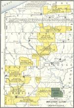
Beginning in 1785, Pennsylvania disposed of 600,000 acres of newly acquired "donation" lands in the west to pay veterans for their services during the Revolutionary War. While a private could acquire 200 acres, a general, such as General William Irvine, who acquired a large tract of land in Warren County, could receive 2,000 acres. Many soldiers sold their land rather than settle on it. By 1800, they had incorporated fourteen other new counties, including Beaver, Crawford, Erie,
  Greene and
  Mercer.
Generous state land sales and the promise of rich soil attracted tens of thousands: Revolutionary war veterans, the impoverished sons and daughters of farm families in New England and central Pennsylvania; immigrants from Northern Ireland and Germany. Western Pennsylvania also continued the Commonwealth's tradition as a haven for religious separatists and dreamers. High in the Alleghenies near the headwaters of the Clearfield River, the young Russian prince-turned-priest Demetrius Gallitzin would lay plans for the Catholic community of Loretto. On an uncleared plot of land on the banks of the Ohio just a few miles north of Pittsburgh, Wurttemberg prophet George Rapp and more than 600 of his German separatist followers organized themselves into the
  Harmony Society, a closed religious community that would endure for nearly one hundred years.
The national government did well by the westerners. A federal army under Anthony Wayne defeated a coalition of the major Indian groups at the Battle of Fallen Timbers on August 20, 1794 – they signed their agreement surrendering their lands at the Treaty of Greenville the following year and Charles Pinckney negotiated the treaty with Spain in 1795 that permitted Americans to ship their goods through Spanish New Orleans, the security of these settlements were in doubt. Geography drew western Pennsylvanians economically into the Spanish economic orbit. Rivers west of the Alleghenies flowed into the Ohio River and from there down the Mississippi River to the Gulf of Mexico.
The British in Canada also actively recruited American settlers with free land. Pennsylvania countered by negotiating with the Iroquois, led by Cornplanter, who sold their claim to the state's northwestern corner for $5,000. The state then had to pay the federal government $150,000 to terminate existing federal land titles to the
  "Erie Triangle," which bordered Lake Erie. Although physically small, this gave Pennsylvania a physical presence in the vast economic system of the Great Lakes. Soon,
 Colt's Station, the first organized settlement in Erie County, gave Pennsylvanians in the northwest corner of the state access to the booming port of Buffalo in New York.
With its boundaries now fixed, more than half the state of Pennsylvania laid north and west of the Alleghenies. To carry the wealth of its western lands to investors and businessmen in the east, Pennsylvanians funded ambitious and expensive road building and navigation improvement projects. Overland travel had always been harder and more expensive than movement on water.
In the early 1790s the state chartered the Philadelphia and Lancaster Turnpike, the nation's first paved toll road, which cut the cost of moving freight between Philadelphia and Lancaster by two-thirds, and became the model for the longer roads, including the
  National Road which by 1836 ran from Baltimore to Valhalia Illinois, passing through the southwest corner of the state of Pennsylvania on the way.
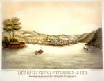
The population of Pennsylvania west of the Allegheny Mountains soared from 75,000 in 1790 to 139,000 ten years later, and in the process the number of counties rose from ten in 1776 to forty-two by 1804. In these years Pittsburgh began to emerge as a great city of the west. Visiting in 1784, Arthur Lee had found the town filled with "paltry log houses...as dirty as in the north of Ireland." In 1805, Thaddeus M. Harris, after passing through a "well cultivated and thickly populated region," reached a city of "wide straight streets," whose merchants carried on "a splendid trade in all kinds of wares from the coast as well as the interior." Except for geographically remote regions, such as the northern Juniata River Valley, by 1800 most of Pennsylvania's western inhabitants lived in a viable commercial society.
From the time
In the 1700s, other colonies claimed much of the land that is now Pennsylvania. The boundary with Maryland wasn't settled until agreement upon the
At the conclusion of the American Revolution, the victorious patriot leadership realized the wisdom of the colonial and British governments had demonstrated in trying to control settlement. Frontier battles - including the French and Indian War and Pontiac's Rebellion- usually began when small groups of unauthorized settlers and Indians clashed over disputed territory. Furthermore, once the American Revolution was over, George Washington and other leaders feared that unless settlement was carefully controlled and led by men with strong ties to eastern leaders and markets, frontiersmen were likely to be courted by the Spanish in Louisiana and the British in Canada and Florida. Numerous plans for a "Westsylvania" or "Transylvania" to secede from the Union circulated around the west in the 1780s and '90s, although historians know little about them aside from the rumors that reached the east.
Eastern leaders were also concerned about the character of western society. They wanted to build roads linking the two regions, ensuring orderly commercial development so western society would resemble that of more settled regions. Without such ties, the west, they feared, would be poor, disorderly, and "democratic," in the worse possible sense of the word. Washington and others also feared that speculators who lacked attachment to the government would take over large tracts and become inordinately powerful without a regulated advance to the west. Western lands were also the most valuable resource the federal government could sell to pay a national debt that had finally stabilized: United States certificates were selling at high prices in Europe.
Securing the western territories negotiated by the Americans at the peace of Paris in 1783, however, was not easy. The year before, Indians destroyed Hannah's Town, the intended capital of newly-formed Westmoreland County, and Pennsylvania frontier militia massacred peaceful Moravian Christian Indians at Gnadenhutten in what is now eastern Ohio.
The British may have lost the war in the east, but their Indian allies had held their own in the west, and were still a powerful military force. In 1784 Pennsylvania forced the New York Iroquois to give up their claims to what amounted to about one-third of the state's current territory. In the years that followed, Pennsylvania tribes not party to this and other treaties, attempted to co-exist, fled west, or continued to launch periodic attacks against white settlers along the western border of the state.
Indian armed resistance strengthened when white settlers made their way onto their lands in western Pennsylvania and the Ohio Valley. In 1790, Little Turtle and 1,500 Miami, Wabash, and Shawnee warriors overwhelmed Pennsylvania troops that General Josiah Harmer had led into the Ohio Valley to subdue them. The following year, General
The succession of forced treaties and military actions opened the lands north and west of the Alleghenies to investors, speculators, and settlers. Settlers poured into the woods of western Pennsylvania and carved out farms and settlements, as investors and real estate speculators back east bought up millions of acres. Southwestern Pennsylvania, what is today Washington, Greene, and Fayette Counties, was the first region to experience settlement. All of George Washington's western lands were located here, as he was reasonably confident that it would become part of Virginia. In 1771 Washington, had bought 2,813 acres in present-day Washington County. In 1784 he was forced to bring suit against David Reed and twelve
Beginning in 1785, Pennsylvania disposed of 600,000 acres of newly acquired "donation" lands in the west to pay veterans for their services during the Revolutionary War. While a private could acquire 200 acres, a general, such as
Generous state land sales and the promise of rich soil attracted tens of thousands: Revolutionary war veterans, the impoverished sons and daughters of farm families in New England and central Pennsylvania; immigrants from Northern Ireland and Germany. Western Pennsylvania also continued the Commonwealth's tradition as a haven for religious separatists and dreamers. High in the Alleghenies near the headwaters of the Clearfield River, the young Russian prince-turned-priest
The national government did well by the westerners. A federal army under Anthony Wayne defeated a coalition of the major Indian groups at the Battle of Fallen Timbers on August 20, 1794 – they signed their agreement surrendering their lands at the
The British in Canada also actively recruited American settlers with free land. Pennsylvania countered by negotiating with the Iroquois, led by
With its boundaries now fixed, more than half the state of Pennsylvania laid north and west of the Alleghenies. To carry the wealth of its western lands to investors and businessmen in the east, Pennsylvanians funded ambitious and expensive road building and navigation improvement projects. Overland travel had always been harder and more expensive than movement on water.
In the early 1790s the state chartered the
The population of Pennsylvania west of the Allegheny Mountains soared from 75,000 in 1790 to 139,000 ten years later, and in the process the number of counties rose from ten in 1776 to forty-two by 1804. In these years Pittsburgh began to emerge as a great city of the west. Visiting in 1784, Arthur Lee had found the town filled with "paltry log houses...as dirty as in the north of Ireland." In 1805, Thaddeus M. Harris, after passing through a "well cultivated and thickly populated region," reached a city of "wide straight streets," whose merchants carried on "a splendid trade in all kinds of wares from the coast as well as the interior." Except for geographically remote regions, such as the northern Juniata River Valley, by 1800 most of Pennsylvania's western inhabitants lived in a viable commercial society.


