![header=[Marker Text] body=[Here is the head stream of this historic river, pathway of Indians, and white traders and settlers for over 200 years. It unites with the Monongahela, 352 miles away at Pittsburgh, forming the Ohio. ] sign](http://explorepahistory.com/kora/files/1/10/1-A-3E-139-ExplorePAHistory-a0a5c9-a_450.gif)
Mouse over for marker text
Name:
Allegheny River
Region:
Pittsburgh Region
County:
Potter
Marker Location:
PA 49, 11 miles NE of Coudersport
Dedication Date:
August 22, 1947
Behind the Marker
In the east, the mighty Mississippi River begins as a small spring in a farmer's field just off State Route 49 near the town of Colesburg, Pennsylvania. This is the headwater of the "Alligewi-hanna," or stream of the "Allegewi," the aboriginal peoples who for centuries lived along its banks. From there, the Allegheny gains size as it flows 325 miles from the Allegheny highlands to Pittsburgh. Along the way it receives the waters of twenty-one major tributaries and dozens of smaller streams that collectively drain an area of close to 12,000 square miles.
Pennsylvanians put the Allegheny and its tributaries to many, often contradictory, uses. They used it to quench their thirst and to fish, to carry away their garbage and wastes; to transport lumber, oil and coal downriver to Pittsburgh and beyond, and for boating, swimming and recreation.
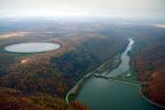
In the nineteenth century the Allegheny became an industrial river, heavily polluted by runoff from mines and oil wells, industries and raw sewage. To improve navigation, generate electricity and control the floods that periodically submerged those along its shores, engineers built eight sets of locks and dams between Pittsburgh and East Brady, making the Allegheny one of the most controlled rivers in the nation.
Allegheny has also been a river of devastating floods, none more famous than the great Johnstown Flood of 1889 on its Conemaugh River tributary. In the 1950s the Army Corps of Engineers wanted to place another flood control dam across the river at Kinzua, on land still owned by the
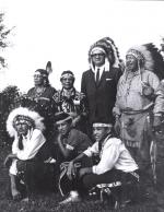
  Seneca nation. One of most vocal opponents – and the only Pennsylvania representative to object – was Johnstown congressman John P. Saylor.
Born on a farm outside Johnstown in 1908, Saylor had grown up with a love of nature instilled by his parents, who owned a hunting and fishing camp in Potter County. On the upper reaches of the Allegheny, the Clarion and the nation's other wild, unspoiled rivers Saylor saw the remnants of the wild frontier of Lewis and Clark. Here Americans could still experience a little of the untamed nature that had shaped American greatness and that could still regenerate their spirits.
Saylor and the Seneca lost the battle against the Kinzua Dam, but in the years that followed he continued his fight for free-flowing rivers. In 1966 Saylor introduced a bill to protect the few remaining unspoiled sections of the nation's rivers from future development – including upper stretches of the Delaware, Susquehanna, Clarion and Allegheny in his home state.
Saylor faced powerful opponents, both in Washington and back home, where Governor Shafer and almost all of Saylor's colleagues in Congress favored further development of the nation's waterways. Supported by the growing legions of Americans interested in protecting the nation's environment, "Mr. Conservation" won the day. Within a decade of passage of the Wild and Scenic Rivers Act of 1968, 1,655 miles on nineteen rivers had been protected. By 1994, there were more than 10,500 miles on 154 waterways including thirteen in Pennsylvania.
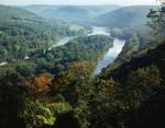
Today, the seventy-two miles of the Allegheny River that flow through the Allegheny National Forest are some of the most beautiful in the northeast. Saylor, Howard Zahniser and other Pennsylvanians played a critical role in the movement to preserve these remnants of Nature's wonders for us all.
Pennsylvanians put the Allegheny and its tributaries to many, often contradictory, uses. They used it to quench their thirst and to fish, to carry away their garbage and wastes; to transport lumber, oil and coal downriver to Pittsburgh and beyond, and for boating, swimming and recreation.
In the nineteenth century the Allegheny became an industrial river, heavily polluted by runoff from mines and oil wells, industries and raw sewage. To improve navigation, generate electricity and control the floods that periodically submerged those along its shores, engineers built eight sets of locks and dams between Pittsburgh and East Brady, making the Allegheny one of the most controlled rivers in the nation.
Allegheny has also been a river of devastating floods, none more famous than the great
Born on a farm outside Johnstown in 1908, Saylor had grown up with a love of nature instilled by his parents, who owned a hunting and fishing camp in Potter County. On the upper reaches of the Allegheny, the Clarion and the nation's other wild, unspoiled rivers Saylor saw the remnants of the wild frontier of Lewis and Clark. Here Americans could still experience a little of the untamed nature that had shaped American greatness and that could still regenerate their spirits.
Saylor and the Seneca lost the battle against the Kinzua Dam, but in the years that followed he continued his fight for free-flowing rivers. In 1966 Saylor introduced a bill to protect the few remaining unspoiled sections of the nation's rivers from future development – including upper stretches of the Delaware, Susquehanna, Clarion and Allegheny in his home state.
Saylor faced powerful opponents, both in Washington and back home, where Governor Shafer and almost all of Saylor's colleagues in Congress favored further development of the nation's waterways. Supported by the growing legions of Americans interested in protecting the nation's environment, "Mr. Conservation" won the day. Within a decade of passage of the Wild and Scenic Rivers Act of 1968, 1,655 miles on nineteen rivers had been protected. By 1994, there were more than 10,500 miles on 154 waterways including thirteen in Pennsylvania.
Today, the seventy-two miles of the Allegheny River that flow through the Allegheny National Forest are some of the most beautiful in the northeast. Saylor,
Beyond the Marker


