Image

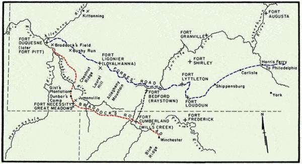
Map of Braddock's Road (red) and Forbes' Road (blue), with the positions of various forts and battles along the way.
Credit: Adapted from Guns at the Forks by Walter O'Meara, 1979, by permission of the University of Pittsburgh Press. Redrawn by Kent Steinbrunner
The path highlighted in red shows the approximate route General Braddock followed towards Fort Duquesne in his failed attempt to defeat French forces there in 1755. The route in blue shows the primitive Raystown Indian and Traders Path that General Forbes followed in 1758 to successfully capture the fort.


